In many developing countries public transport is not comparable to the way we are used in our modern western societies. In our society we use mobile applications to look up information regarding trains, buses, metros and trams to get to our destination. However, in developing countries these apps do not exist simply because the lack of an extensive public transportation network. In cities from Bogota (Colombia) to Addis Ababa (Ethiopia), public transport is mainly offered via informal privately owned transport companies. These essential networks are almost invisible for governments but increase the mobility of its citizens.
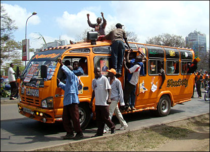
When moving around in for example Nairobi, many citizen are appointed to make use of so called matatus. These are small vans that are privately owned and play a crucial role in local transportation. The principle is as follows: passengers walk to a certain location where the vans are parked and scream their destination. A private driver might react by acknowledging that this location is on the route he is planning to ride. As every matatu owner decides its own route to be profitable, locals start recognizing the right van for the right destination. However, this information was only available for individuals who had experience in making use of these matatus simply due to the learning by doing principle. As a consequence, the system did not work for non-experienced people, like for example tourists and non-locals. Another issue was the safety of these rides as matutus were also involved in many violent crimes and the fares of these rides were even more emotional than the stock markets.
To solve this issue, in 2013 researchers from Columbia, MIT and the University of Nairobi collaborated to create an illustration of the matatu network in Nairobi. The so called “Digital Matatus Project” tried to create a map of all routes which are offered by the many private owned matatus. The research was conducted as follows: by using geo-locative capabilities of the researchers’ mobile phones they collected data on routes, stops, departure locations and arrival locations. Eventually, the team collected over 3000 matatu stops with over 100 matatu routes. Subsequently, they sorted the data into a General Transit Feed Specification format (GTFS) that is used by other parties to include the information in their public transportation schedules (for example Google Maps).
As the geo-location research proved to be successful in Nairobi, the next step is collecting data from private phone users to map other cities in developing countries who rely on the same kind of transport. By making use of citizen’s location via their smartphones, governments can be able to use big data to create their own information regarding the transportation opportunities in their cities. One way to collecting this data on public transit is to make use of inputs in apps such that even when playing games, citizens are generating data on their location.
As the potential is enormous, a drawback of the use of geo-location data of individuals might be the loss of privacy. Therefore, governments should always consider the public value of a clear transportation system versus the privacy of their own citizens.
More information regarding the project can be found below:
http://www.sciencedirect.com/science/article/pii/S0966692315001878
http://news.mit.edu/2015/digital-matatus-project-makes-invisible-visible-0826